Most grading and drainage plan submittals don’t fail because the engineering is wrong. They fail because something is missing: a soils report the reviewer wanted on day one, a flow arrow pointing the wrong way, a stormwater note that doesn’t match the site plan. Each of those costs a round of comments, and a round of comments usually costs three or four weeks. This is how we put a grading and drainage plan together so it gets through review with as few trips back as possible.
Start with the survey and the soils report
A plan is only as good as the ground it’s drawn on. Before anyone draws a contour, you need a current topographic survey that shows existing elevations, property lines, easements, utilities, trees and anything on the neighboring parcels that affects drainage. A survey that’s three years old, or that stops at the property line, will cause trouble later.
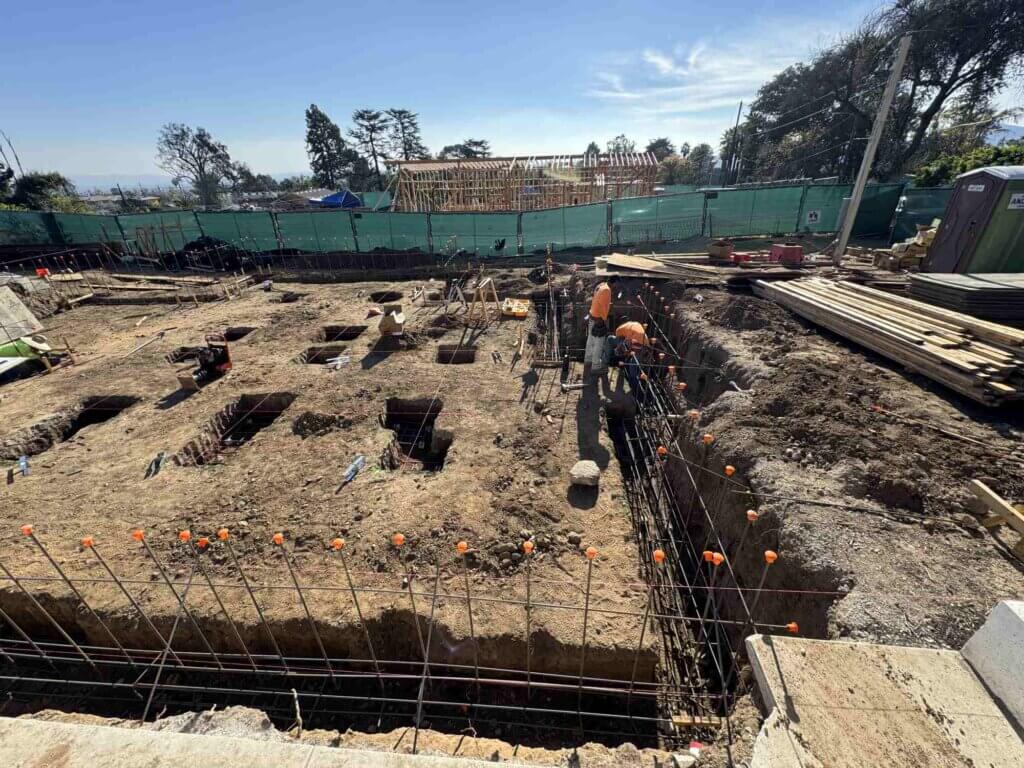
The geotechnical report matters just as much. It tells the engineer what the soil can carry, how fast water moves through it, whether groundwater is close to the surface, and what the grading should look like near slopes and retaining walls. Plenty of reviewers want it before they’ll comment on anything else. If you’re still waiting on it, start a preliminary plan anyway, but flag what depends on it.
Find out who reviews it and what they expect
Every jurisdiction has its own checklist, and they don’t line up. One city wants a separate erosion control sheet, another folds it into the grading plan. One asks for earthwork quantities on the cover, another buries them in a table. Cities across Orange County and Los Angeles tend to differ on small things like required scales, notes and signature blocks, and those small things generate comments.
So pull the checklist before drafting, and look at the threshold for needing a grading permit at all. Many jurisdictions require one once earthwork passes a modest volume, often somewhere around fifty cubic yards, though it varies. If you’re near that line, assume you’ll need one.
Settle the concept before you draw anything
The best grading and drainage plans start as a sketch. Where does the building pad sit? Which way does water leave the lot? Where does it get discharged, and is that discharge point legal? Answering these on a napkin takes a day. Answering them after the architect has locked a floor plan can take a redesign.
This is also when you set finished floor elevations, which depend on the street, the storm drain and the sewer, and sometimes on a flood zone. We usually give the architect a preliminary set of numbers early, so the building and the site agree before either is too far along.
What actually goes on the sheet
The reviewer needs to view both current and planned ground surfaces so the sheet displays their corresponding contour lines and corner pad elevations together with elevation points for the highest and lowest areas and all terrain elevation shifts. Flow arrows show where water goes. Swales, inlets, pipes and outlets are labeled with sizes, slopes and invert elevations. Retaining walls appear with top-of-wall and bottom-of-wall elevations.
The project demands three main elements which include a benchmark and cut and fill summary and tree protection details together with grading boundaries and all mandatory notes from your local government. The earthwork phase becomes visible through rough grading plans which also show final pad locations and paving areas and flatwork surfaces. Some projects need both, others need one combined sheet.
Don’t treat stormwater as a separate job
This is the mistake we see most. The grading and drainage plan gets drawn, approved in concept, and then someone realizes the site needs a treatment device and detention, and neither fits. A bioretention planter takes real space. So does an underground storage chamber. If those weren’t in the grading from the start, the pad moves.
A hydrology and hydraulics report sizes the pipes and the detention, and it’s usually the document a reviewer asks for first when runoff leaves the site. The WQMP and the SWPPP follow from the same grading, and an erosion control plan covers the construction period. Drafting all of them together means the BMPs, the elevations and the stormwater management design come from one model instead of three.
Check the boring details
A few unglamorous numbers sink more plans than big mistakes do. The California Building Code expects the ground next to a foundation to slope away at five percent for the first ten feet, and impervious surfaces close to the building at two percent. Where a lot line or a wall prevents that, you need a swale or a drain and you need to show it.
Accessible routes have their own limits. Running slope generally can’t exceed five percent without becoming a ramp, and cross slope is capped at two percent, so a parking lot that drains nicely but leaves the accessible stall at three percent will come back marked up. ADA site plan compliance is far easier to check on paper than after the concrete is poured.
Retaining walls deserve a mention too. Their heights, drainage and surcharge loads show up on the grading plan and on the structural drawings, and the two have to agree.
Coordinate with the rest of the team
A site never stands alone. The structural engineer needs finished floor and footing elevations, the MEP team needs the sewer and water connections and the architect needs to know where the driveway can land. Public street work, such as a new apron, a sewer lateral or a storm drain tie-in, adds civil improvement plans and sometimes an encroachment permit.
If those pieces come from different firms, make sure someone checks them against each other before submittal. When the civil, structural and MEP work comes from one team, the conflicts get caught earlier, and that’s a large part of why plan check goes faster.
What reviewers tend to send back
Three comments show up again and again. The first is missing or inconsistent information: elevations that don’t match the survey, a note that contradicts a detail, a sheet that wasn’t updated after a revision. The second is drainage that leaves the property in a way the city won’t accept, often onto a neighbor. The third is stormwater, either the wrong document or the right one with no room on the site to build it.
Answer each comment directly, sheet by sheet, and mark what changed. A clean response letter saves a reviewer time, and a reviewer who isn’t hunting for changes tends to approve faster.
Where we start
If you have a project that needs a grading and drainage plan, send us the address, a short description of the scope and any survey, site plan or soils report you already have. We’ll tell you which civil documents the project needs, name the agencies involved and send back a fee and schedule in writing, usually within 24 hours. Call (949) 482-7835.