The short answer is earlier than most teams think. WQMP preparation usually gets pushed to the point where someone asks for it, which is often the moment the site plan is already full. By then the choices are narrow, the treatment features cost more than they should, and the schedule has a new item on it. The better answer is that it should start when the site plan is still a sketch, and what follows is why.
The plan is tied to the layout
A water quality management plan isn’t a standalone document. It depends on how much of the site is paved or roofed, where the water drains, which soils are underneath and how much room is left for treatment. All of that comes from the site plan, which is also the thing the architect is trying to finalize.
That makes timing a trade-off. Start too late and the layout has no space for the features. Start too early with nothing to size and you’re guessing. The sweet spot is when there’s a rough building footprint, a parking concept and a preliminary idea of where the site drains, even if the details aren’t set.
At feasibility and due diligence
The first useful moment is before you close on the land. A developer weighing a commercial parcel is already looking at zoning, utilities and access, and the stormwater question belongs on that list. Is the site flat or sloped? What do the soils look like? Is there a creek, a flood zone or a known contamination issue that would rule out infiltration?
None of this requires a full plan. A short review of the parcel, the likely impervious area and the agency’s requirements will tell you roughly how much land the treatment features will take. We’ve seen buyers lose a pad or a row of parking they were counting on because nobody asked until after closing, and a 20-minute conversation up front is a cheap way to avoid that.
Before the site plan is locked
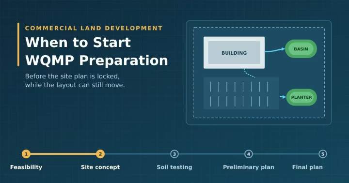
The next moment is when the architect is laying out the building, parking, loading and landscape. This is where WQMP preparation earns its keep. With a draft footprint and a rough drainage concept, we can estimate the design capture volume and sketch where bioretention areas, planters or other features might go.
Moving a landscape island or shifting a drive aisle by ten feet costs nothing at this stage. Once the grading plan and the architectural set are far along, the same change touches the civil drawings, the landscape plans, sometimes the plumbing and the structural sheets. We try to get this feedback to the design team in the first couple of weeks, while the plan can still flex.
Infiltration testing comes early too
Infiltration is the preferred way to handle runoff, and whether it works depends on soil permeability, groundwater depth and nearby structures. Those are answered with field testing, which takes scheduling and a geotechnical consultant. If the testing isn’t done until the plan is nearly finished, a “no, this site can’t infiltrate” result forces a redesign using a different type of feature.
Ordering infiltration testing alongside the geotechnical investigation, not after it, is one of the simplest ways to keep a stormwater package on schedule. It gives the plan real numbers instead of assumptions, and it tells you early whether you’re designing for infiltration or biotreatment.
The preliminary version and the final version
Many agencies split the document into two stages. A preliminary version goes in during entitlement or early review, and it shows the strategy, the capture volume and the proposed locations. A final version follows before the grading permit, with the detailed design, test results, calculations, maintenance agreement and supporting exhibits.
In Orange County, as in several other places, the preliminary version is expected with the entitlement application, which pushes the start of work well ahead of grading. If the preliminary plan puts a basin in a spot and the final design can’t deliver it, you end up amending an approved document, and that’s slower than getting it right the first time.
The exact sequence varies by agency, so the first step is always to check what the local agency expects and when.
Coordination with the grading and drainage plans
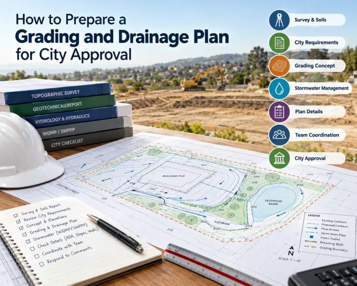
The WQMP, the grading plan and the drainage plan all describe the same site, and they need to match. The drainage areas on the WQMP exhibit should line up with the grading sheets, and the pipe sizes in the hydrology report should reflect the same impervious values. When one of these gets updated, the others have to follow.
For that reason, we build the water quality plan from the same base as the civil set instead of as a separate deliverable. It saves reconciliation work, and it keeps a plan checker from finding two versions of the same site.
Linking to the construction-phase documents
A WQMP covers the finished project. During construction, a SWPPP and erosion control plans keep sediment out of the storm drain, and they have to respect the permanent design. If the future infiltration area becomes a stockpile or a haul road, the soil compacts and the feature stops working.
Those documents are usually prepared closer to the grading permit, but the sequencing needs to be thought through during the WQMP stage. Protect the basin footprint, build the permanent features late in the schedule and stabilize before final inspection.
A practical timeline
For a typical commercial site, the order looks something like this:
- Feasibility: a quick review of site conditions and agency requirements.
- Conceptual site plan: capture volume estimate and rough feature locations.
- Geotechnical work: infiltration testing and soils recommendations.
- Entitlement: preliminary WQMP submittal where the agency requires one.
- Design development: final WQMP alongside the grading, drainage and utility plans.
- Grading permit: the final WQMP, maintenance agreement and recorded documents.
The details move around by jurisdiction, but the principle holds: the earlier the stormwater thinking starts, the cheaper the changes are.
Where we start
If you’re planning a commercial site and want to know when the stormwater work should begin on your project, send us the address, the proposed building and parking layout and any soils or survey information you already have. We’ll tell you what the plan will need, flag the likely trouble spots and send a written fee proposal. Call (949) 482-7835.